
 |
| Bowscale Tarn and Bannerdale Crags, Mungrisdale. |
The mountains of Lake District National Park, in Cumbria, England, are an absolute paradise for outdoor enthusiasts. My mum grew up near here, in Silloth, on the Solway Firth, so the area is familiar. We journeyed south from Scotland this past weekend to take a two day micro-navigation course, followed by some time putting theory into practice. Twelve of us were on the course and we gathered in the tiny village of Mungrisdale, located at the foot of the imposing fells (hills) of Blencathra, Bowscale and Carrock.
 |
| Operational telephone booth in Mungrisdale. |
So, after two very enjoyable and instructive days in the classroom and in the nearby hills, it was time to plot a course on the topo map and in the Garmin 62s...and head out. We chose the 12 kilometre (return) hike up to Bowscale Tarn. It promised "a lonely and haunting landscape" and a "perfectly formed tarn".
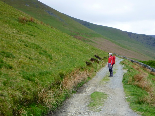
The hike began with a couple of kilometres along the quiet country road. The only sounds were the sheep and the singing of the birds.
 |
| A quiet road and fields enclosed by dry, stone walls. |
 |
| The hill known as the "Tongue". (A topographic map will explain.) |
 |
| His and hers? Sweet. |
 |
| Sometimes you just stop, to breathe it all in. |
 |
| Gentle, as a lamb. |
 |
| Waiting for us to catch up. |
 |
| Eye contact and an apparent conversation. |
 |
| Looking over to Carrock Fell. |
 |
| The tarn and the crags above. |
Arriving at the tarn, you find yourself in a giant amphitheatre, carved by glaciers. It was extraordinary.
 |
| Joan, in the bottom right, gives scale to the tarn. |
According to the English Romantic poet, William Wordsworth, there are two immortal fish that live in this ancient tarn. In his poem, "Song, at the Feast of Brougham Castle", he writes,
Both the undying fish that swim
In Bowscale tarn did wait on him;
The pair were servants of his eye
In their immortality;
 |
| Alone. |
Although this was a very straightforward hike on an obvious trail, it was clear how valuable a GPS device can be. Loaded with Ordnance Survey UK 1:50k scale mapping, it is an easy matter to plot a course, follow it, retrace it, and see at all times exactly where you are. Some more practice with paper maps, in conjunction with lots of time with the GPS, and we'll go back to Driesh and Mayar and hike them again - with much more confidence.
Reflecting on the weekend in Mungrisdale brought to mind the fact that life itself, can very much be an exercise in micro-navigation. Sometimes we try to go it alone, without any clear "mapping" strategy for our lives. Sometimes, it works out. Sometimes, however, we find ourselves feeling a little lost and unsure of where we are and where we are going. It never hurts to ask for direction.
Sharing our stories, our experiences, and our journeys in life with one another, can often provide insights and illuminate important "waypoints". And when we truly listen to one another, we discover there are few "places" others haven't been. It is at these times that they may well be able to show us the way, and even accompany us on the path.
Perhaps someone out there can confirm the existence of Wordsworth's two very old fish? ;)
Thanks for spending a few moments here.
Duncan.
The hills look beautiful and the sheep very friendly. Glad you took the class and now we won't have to worry about you getting lost over there!
ReplyDeleteL
Excellent words Duncan; a pleasure to read and ponder. I was taken back to my Yugoslavia days...I was convinced I wanted to be a Sheppard after watching the men with sticks herding their flocks around and sleeping in the midday sun. It looked like a literal dream job at the time.
ReplyDeleteI and still asking around for direction and got some I didn't like; some I'm afraid to try. Not much of a mapping strategy yet!
Hi L, I don't think you really ever had to worry. Haha. D.
ReplyDeleteThanks for that, Lee. I know what you mean, we watched these modern day shepherds and their dogs and marvelled at the way they could locate and recover their flocks, scattered over a vast territory. And to spend time in the hills, well, it's a bit like spending time on the water in our kayaks isn't it. I'm still searching for direction too, I think it's a life-long process. But so long as we're searching, it's a dynamic process. It's the "static" process of not searching, being afraid to ask those questions, and not believing in ourselves that gets us stuck. From my perspective, I think your inner compass is working well. You can trust it, especially with all the experiences you have had and continue to have. We all just need to be patient with ourselves. That in itself is part of the "mapping strategy". Warm wishes, friend. Duncan.